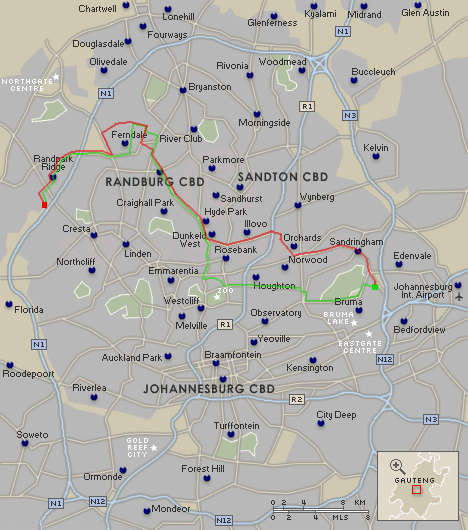
I found a suitably appropriate map on the net, and edited it to show the rough trips. Green is on the way to work (and the green square is where my offices are) and red is the route back (and the red square is where we live). The freeways are in blue, and you can see the ring formed by the N1 to the west and north, N3 to the east, and N12 to the south.
The route to work may seem, from the map, to be shorter via Cresta and Linden, but the traffic along those route can pretty terrible (and I wouldn't be able to drop Morgan off at school).